25 November 2014 | CIL Seminar Series
Understanding Article 76 and the Challenges of Mapping the Arctic
Introduction
Article 76 of the UN Convention on the Law of the Sea (UNCLOS) provides a mechanism whereby a coastal State can extend its sovereign rights over the resources of the seafloor and subsurface far beyond the 200-nautical mile Exclusive Economic Zone if certain geological and morphological criteria are met. To establish whether a coastal State is entitled to this “extended continental shelf”, a coastal State must map the seafloor and the subsurface. Despite the fact that the United States (US) has not yet acceded to UNCLOS, the US treats most of the Treaty as customary international law and, since 2003, has charged the Center of Coastal Mapping at the University of New Hampshire to carry out the mapping necessary to establish the limits of a US extended continental shelf. To date, more than 2,000,000 sq. km of new high-resolution multibeam sonar data has been collected in support of this effort, resulting in the discovery of many new deep-sea features. The majority (in time) of this effort has been focused on the high-Arctic, in the region of the Chukchi Cap, where the US has the potential for a very large area of extended continental shelf in an environmentally sensitive but resourcerich region. This talk looked at what it takes to establish an extended continental shelf through Article 76, explored modern tools for mapping the seafloor and how they can be applied to ice-covered regions in the Arctic and shared some of the results and experiences of more than eight seasons of working and mapping in the high Arctic.
About the Speaker
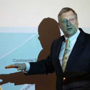
Larry Mayer is a Professor and the Director of the School of Marine Science and Ocean Engineering and The Center for Coastal and Ocean Mapping at the University of New Hampshire. He graduated magna cum laude with an Honors degree in Geology from the University of Rhode Island in 1973 and received a Ph.D. from the Scripps Institution of Oceanography in Marine Geophysics in 1979. At Scripps he worked with the Marine Physical Laboratory’s Deep-Tow Geophysical package, applying this sophisticated acoustic sensor to problems of deep-sea mapping and the history of climate. After being selected as an astronaut candidate finalist for NASA’s first class of mission specialists, Larry went on to a Post-Doc at the School of Oceanography at the University of Rhode Island where he worked on the early development of the Chirp Sonar and problems of deep-sea sediment transport and paleoceanography. In 1982, he became an Assistant Professor in the Dept. of Oceanography at Dalhousie University and in 1991 moved to the University of New Brunswick to take up the NSERC Industrial Research Chair in Ocean Mapping. In 2000 Larry became the founding director of the Center for Coastal and Ocean Mapping at the University of New Hampshire and the co-director of the NOAA/UNH Joint Hydrographic Center. Larry has participated in more than 90 cruises (over 70 months at sea!) during the last 35 years, and has been chief or co-chief scientist of numerous expeditions including two legs of the Ocean Drilling Program and five mapping expeditions in the ice covered regions of the high Arctic. He has served on, or chaired, far too many international panels and committees and has the requisite large number of publications on a variety of topics in marine geology and geophysics. He is the recipient of the Keen Medal for Marine Geology and an Honorary Doctorate from the University of Stockholm. He was a member of the President’s Panel on Ocean Exploration, National Science Foundation’s Advisory Committee for the Geosciences, and chaired a National Academy of Science Committee on national needs for coastal mapping and charting as well as the recently completed National Academies report on the impact of the Deepwater Horizon Spill on ecosystem services in the Gulf of Mexico. He is currently cochair of the NOAA’s Ocean Exploration Advisory Working Group, Vice-Chair of the Consortium of Ocean Leadership’s Board of Trustees, and a member of the State Dept’s Extended Continental Shelf Task Force and the Navy’s SCICEX Advisory Committee. Larry’s present research deals with sonar imaging and remote characterization of the seafloor as well as advanced applications of 3-D visualization to ocean mapping problems and applications of mapping to Law of the Sea issues, particularly in the Arctic.
